Composite
Definition
The simultaneous dissolution of one or multiple municipalities and the merger of their entire or partial territories, along with other pre-existing municipalities, into newly created municipalities.
Implication of the change
Before (year t):
- Municipality A (with id 11), B (with id 2), C (with id 3), D (with id 4), and E (with id 5) exist as separate entities, each with its own name, id, and territory.
After (year t + 1):
- Municipality A was dissolved. Part of its territory participated in a merger to create a new Municipality F, while another part participated in a merger to create a new Municipality G.
- Municipalities B and C were dissolved.
- Municipality F was created, covering the combined territory of Municipalities B and C, and a part of territory from Municipality A.
- Municipality F either retains one predecessor’s name/od or receives a new name/id.
- Municipalities D and E were dissolved.
- Municipality G was created, covering the combined territory of Municipalities D and E, and another part of territory from Municipality A.
- Municipality G either retains one predecessor’s name/od or receives a new name/id.
Visual overview
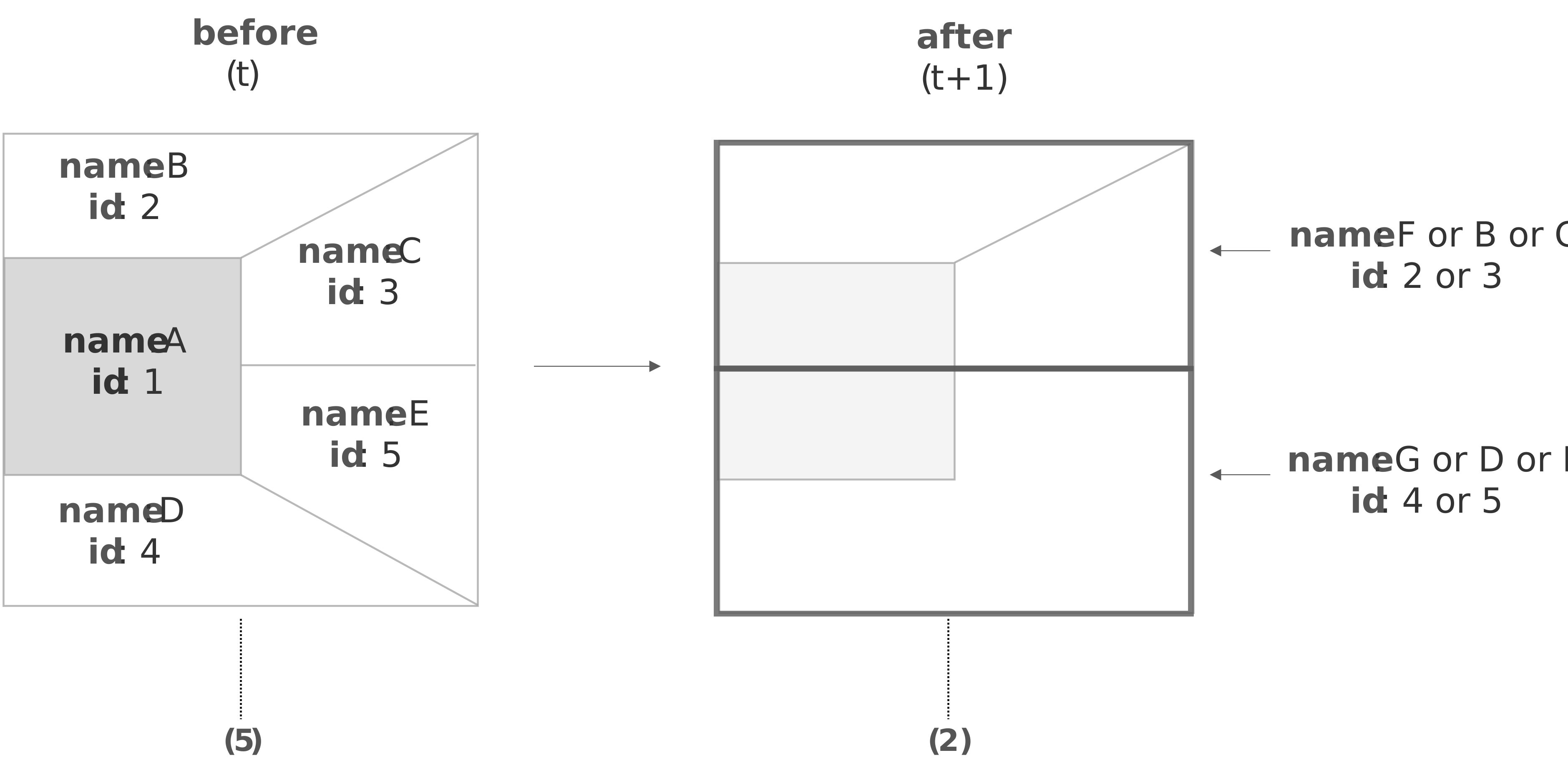
The number of municipal units involved is indicated in brackets under each description.
Example
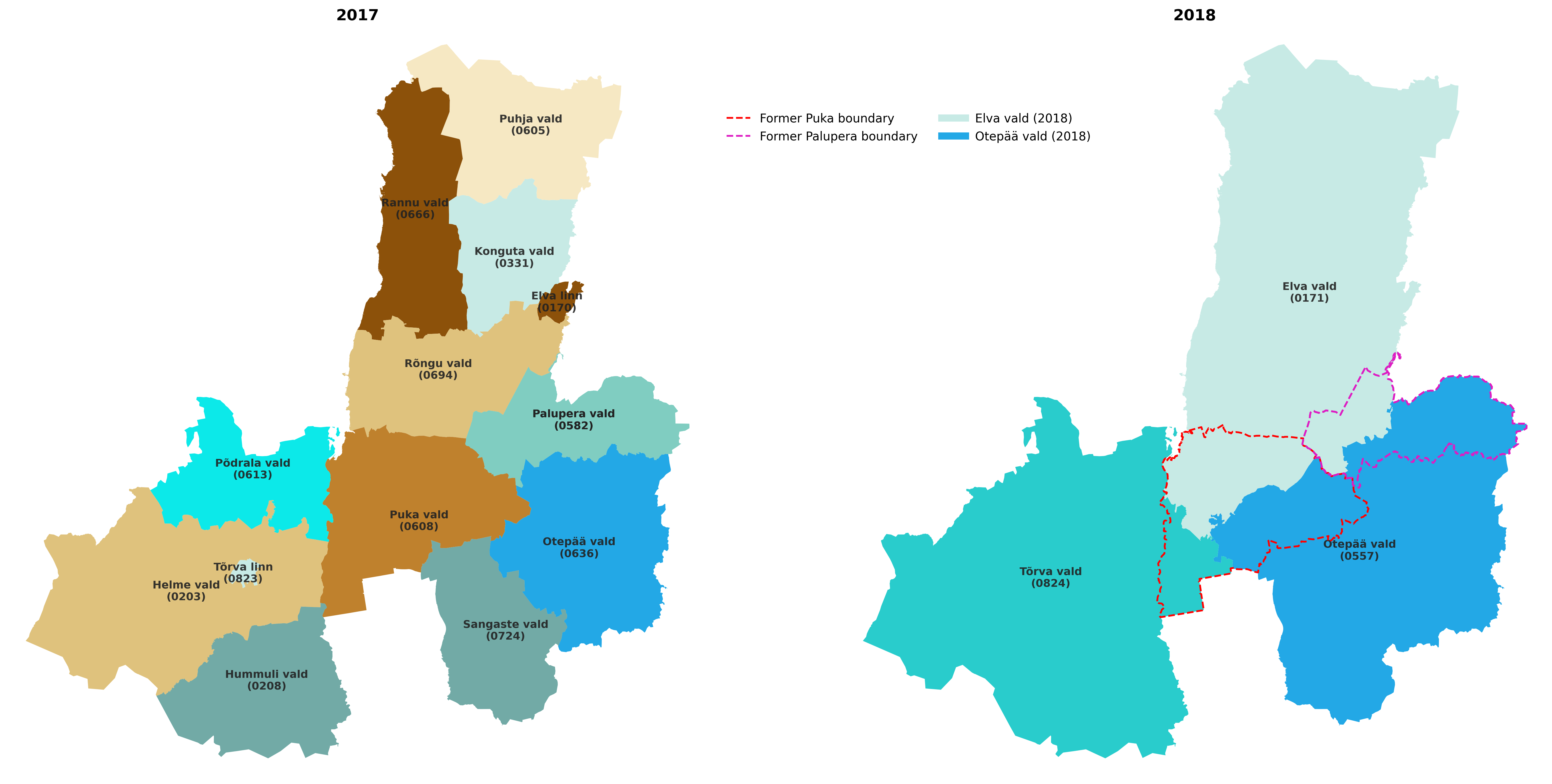
Since 2018, the municipality Palupera (vald in Estonia, id 0582) was dissolved, and its entire territory was divided between two newly created municipalities: Elva (id 0171) and Otepää (id 0557), each receiving 7 villages. At the same time, the new municipality Elva vald (id 0171) was created through the merger of the municipalities Elva linn (id 0170), Konguta vald (id 0331), Puhja vald (id 0605), Rannu vald (id 0666), Rõngu vald (id 0694), and part of the former Palupera municipality (7 villages) (source). The new municipality Otepää vald (id 0557) was created through the merger of the municipalities Otepää vald (id 0636), part of Puka vald (id 0608), Sangaste vald (id 0724), and the remaining part of Palupera municipality (7 villages). The case was registered in the metadata dataset under the id: ee-cr-1-2017-2018.
Plots
Before(left) and After (right)
References
-
By id we mean code identifier of the municipality. ↩